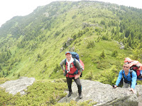
Long awaited and planned mountain track peak Midjur to peak Kom managed to place in early July (to gather all the mountaineers group). It is recommended to leave their cars in the parking lot next to the factory in Gorni Lom, because the road then becomes bad. Pass through a small hut to the left of the road, which unfortunately was closed when we passed. There were two earth moving machines that made the road as motorists soon there'll be skiing and other interesting things for tourists.
Walk on the road about 2 km to the road to the border with Serbia. The marking of this place is not visible (at least I never saw her again) and begins a long walking through high grass and juniper. It can tell that this route is not visited much, because the trail is quite overgrown. It needs to be equipped with high boots and long pants to avoid injuries to the nettles and juniper. Later we learned that in these places there are many poisonous snakes, which I never saw. Approximately two hours sweating in this grass until we reach the border.
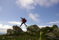
Deserved rest for 40 minutes and again right up already in the furrow. The weather was more than good. Sunny - perfect for photos. The total displacement of the catwalk to Midjur peak is 1400 meters. At 14:00 we were Midjur peak 2168 m. Rest about 50 minutes and a lot of pictures and videos that apply in the article. Care borderline not been made for decades. Yet survivors old pyramids, which writes the PRB and SFRJ, and new small and RB STSG. The boundary will use it as it was in my time when I was border soldier 1988-1990 year.
Security is different, we saw Serbian soldier taking pictures shortly after peak Midjur and Bulgarian border police after Kopren. After Midjur peak we were pretty tired and time progressed and I had to think about the first camp. The wind of Bulgarian intensified, it became cold and did not have much choice. Eating and Drinking quickly tents. 7.00 hours in the morning we met a dense fog and cold weather. If it were not navigating honestly tell you I would not going to anywhere. Even if you follow the border pyramids, is no guarantee of smooth progress. We chose to go on the Serbian road that we thought quite pleasant. Even we preserved the forces and the weather is clear. In several places there were gullies that flowed nice cold water. Not to overdo walking this path because at one point he enters Serbian territory.
At 11:00 we were at peak enemy Chapter. Travel it from the Bulgarian side, but unfortunately there was fog and I could not photograph him. Actually fog had a lot of time and we could not enjoy the view from Three Chuki. And we try to pass of Bulgarian and a steep chute we got the first Hammer. The descent from Three Chuki least for me was not a problem. Comes the peak Kopren that remained in the fog to last, even if we passed it up because the border is equal, but the Bulgarian side are steep cliffs. The descent is difficult and it is important to choose the right approach to not get stuck in the cliffs on the right. We chose a chute on the left and lower coil (zigzag). It is good to know that is not always someone hacking peak is a better option.
From far it seems easy to chapped, but getting into some grass and squats from which no exit. The advantage to climb the ridge is little grass and shortened track at the expense of climbing (up and down). Let us give special thanks to Nikolay Dimitrov and his satellite navigator, which found water before landing Stone. It is good to have in your backpack least 2 liters of water, because dehydration is high at this altitude. Grass so I had passed through his life. Overall most of the time we walked in until we Serbian terraces. They obviously have gathered Bulgarians and Serbs as fair, but frankly the way there is much, at least from the Bulgarian side. At the moment everything is overgrown and the tendency to revive this event is void. Road passes through dense forest already in Bulgarian territory.
Our forces were exhausted and began to think about the second camp. At 18:15 we reached the path that apparently soon was gone jeep (two-month). Tents built them to the road. The altitude of the camp was in a forest at 1,600 meters. A quiet place ideal for camp. Sleeping in a tent is great, especially if you are very tired. The morning after a brief awakening and yawns leave this forest road. It's so overgrown in places that wet grass wet and without shoes wet from the day before. Fallen trees grass and nettles are common
along the road that border guards are crawled every day before the fall of barbed wire fencing. Come out successfully from the forest, a short break for taking breath and the road continues to the peak Morning. We go down the slope and climbing to the top. Shortly before the peak Good Morning I find that my jacket had fallen. Horror. Last I saw a pack of about two kilometers before. A run-down looking for him. In Murphy's Law, do not find anywhere. The problem is not that will be extra tired, and that will slow down the group because Kom peak is still very far away. I get to where I last saw her jacket. Red in color, easy to see even from far away. Suddenly the forest ask two people walking opposite me. After brief explanations (as I found out they were Bulgarians from Montana) offered me his help in search of that jacket. Special thanks to Krasimir Tankov, which after 20 meters down into the wooded path found it. It turned out that we observed for some time from the border. Who Krasimir Tankov - mountaineer, photographer, lover of nature and guide Northwestern Bulgaria. He offered his help to my group caught on quickly in peak Good Morning. There was no denying, given that I could not connect the station with my people. The pictures that I made the top are unique. Of course I made the top link on the radio and on the ridge down began to overtake them. After two kilometers we had together with my group. Krasimir Tankov
and his friend escorted us to the heights they repair Zmiyanets us how to get to Mount Kom. Finally we saw the border police who check us out, escorted and monitored in the next few hours. The road is very convenient and easy under the limit, but we already third day walk and fatigue began to pressure us. The trail passes near the ruined outpost under Mount Silver and his barely visible wire enclosures (only the pillars are left). The frontier made a short break and split with border guards last. After a short climb on one of left turns saw Kom Peak. Many far we do (at least 3-4 hours).
It was 16.00 hours, but the end of our journey is in sight. With the last forces around 18.30 hours we were at the peak Kom. We only had two hours to wait until the weather becomes more clearly and make good panoramic photos to enjoy the beautiful scenery of Bulgaria. Hut Kom is 1 hour down from the top. Actually two chalets Kom. Old and new. New is preferable because it has rooms with bathroom. What you need to know before you take such a long and difficult route?
Permit from the Border Police, at that time you will be on the border. It is imperative to know where you are going - is needed track, mountain insurance. Of equipment are the most important shoes (thick-soled mountain) 50-60 liters backpack with essentials such as food and drink for three days, tent, sleeping bag and mat (mat), raincoat and jacket. Good physical condition is mandatory to not receive mutterings when someone is tired (annoying). Without exaggeration pack is about 20 kg. and weighs a lot, shoulders aching cool and blisters are common.


No comments:
Post a Comment